Urban Behavior Mapping for Public Space Assessment
A Computer Vision Approach to Pedestrian Analysis in Venice
IUAV University of Venice
Sun Haihang, Tosi Maria Chiara, Francesco Bergamo
Abstract
This study investigates the relationship between pedestrian behavior and the spatial usage of public space in Venice, based on the urban research methodology. By applying computer vision techniques, the study visualizes human activity in a public square. This study enables the application of visual data in geospatial analysis by distinguishing types of behavior in short-term image sequences, providing a new method for quantifying the use of public spaces. By integrating urban morphology, urban context, behavior type, and time pattern, the study enables a layered spatial interpretation of public environments.

Public Space in Venice

Campi as Venetian Public Spaces


Campo San Giacomo di Rialto


From Observation to Data Processing


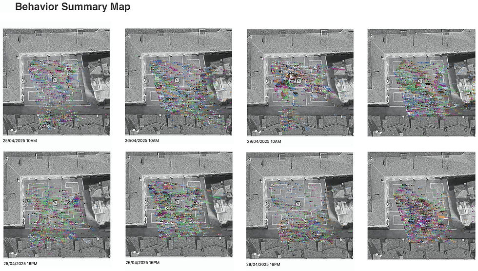


There is a clear correspondence between trajectory maps and heatmaps. Areas with continuous and dense path distributions in trajectory maps align closely with the high-density striped zones depicted in heatmaps, particularly evident in the north-south diagonal movement patterns within the square.
The trajectory map supplements dynamic characteristics not captured by the heatmap: beyond the main pathways, lateral or diagonal traversals across the plaza are observable. This indicates that crowd movement is not entirely constrained by a single flow pattern but instead forms diverse passage routes based on immediate needs and spatial conditions

MORE WORKS


